
![]()
Benefit from more intuitive navigation. DISCOVER™ X combines the latest and greatest C-MAP® map data with all the essential features you need for a safe and smooth journey – no matter the day or weather.
M-EW-T-227-D-MS
Today's order deadline is:
Produktinformationen im Onlinekatalog:
Artikelnummer: M-EW-T-227-D-MS

![]()
Benefit from more intuitive navigation. DISCOVER™ X combines the latest and greatest C-MAP® map data with all the essential features you need for a safe and smooth journey – no matter the day or weather.
Navigation is easier and more intuitive than ever before. With the latest tools, first-class day and night modes, and improved autorouting, you can always make the most of your time on the water.
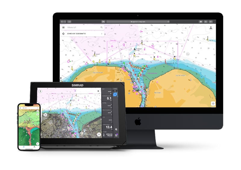
Integration with C- MAP® , Simrad® and B&G ® The app brings the beauty of X-Gen charts to all your devices. Users already using X-Gen charts on their chartplotter can also use them on tablets and mobile phones. Plan trips, check tracks, and record waypoints with the app, and sync them directly to your chartplotter without the need for an additional subscription.
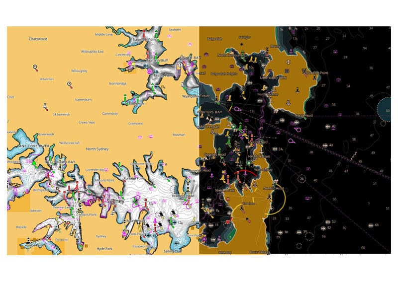
Special day and night modes designed for maximum visibility and ease of use in all light and weather conditions. Always see all the necessary details. You are safe and can navigate with ease.
Easier navigation thanks to accurate, up-to-date vector map information obtained from official sources, including hydrographic institutes.
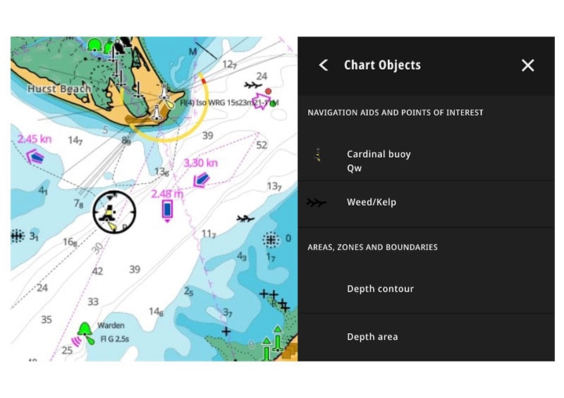
Quickly view information on locations, POIs, tides, channels and more – all with just one touch of the screen.
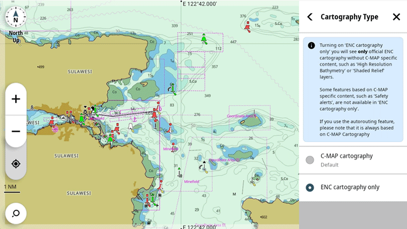
With the new Electronic Navigation Charts (ENC Cartography) option, you can view a representation of the official chart produced by national hydrographic offices around the world*.
*Please note that this chart cannot be used in an IMO-approved ECDIS system and is not available at all locations.
![]()
High-resolution bathymetry
Helps you identify flat areas, slopes, protrusions, holes, or shallows. Includes the best C-MAP HRB data with integrated Genesis® Social Map data.
![]()
Custom depth shading
Allows you to define a safe depth and set your own color tones for more efficient fishing. Customize the view entirely to your liking.
![]()
Tides and currents
Displays projections of water level and tide direction to help you plan your day of cruising or fishing.
![]()
Marina and harbor plans
Mooring in an unfamiliar port is completely straightforward if you have precise layouts of the marinas, including boat slips and restricted areas, as well as other valuable navigational information at hand.
![]()
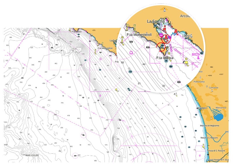
Port and approach details
Unprecedented level of detail. Enables safe entry into every bay and harbor. The perfect partner at the end of a long trip or an exciting day of fishing.
![]()
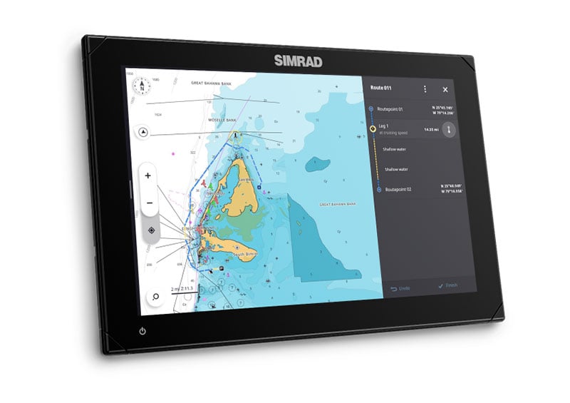
Autorouting without a subscription
Automatically plot the shortest and safest route based on detailed map data and your ship information.